


Monega Pass
Description:
A world-class mountain bike ride on two ridges in the superb surroundings of the Southern Cairngorms National Park. This old Droving route, in the north of the Cateran Ecomuseum, starts at the Bridge of Forter, north of Kirkton of Glenisla and Folda, which both provide alternative parking if needed.
After a gate the route uses a landrover track on the eastern side of the River Isla, passing a few houses along the way to Linns. Here a bridge crosses the river just north of Auchavan, and after a short section through a woodland the route follows a gravel path north.
After a bridge the route follows an estate track past Tulchan Lodge and along Glenbrightly Burn and Collie Shiel Burn, with a few fords along the way. The route climbs continuously with some steep sections towards Little Glas Maol, at 973m metres the highest point of the route.
For those wanting to cycle the highest pass in Scotland, continue on the track instead of taking a right turn. This track leads you past Glas Maol on the Monega Pass to Cairn Claise, at an altitude of 1052m.
For those not interested in more climbing (there is another ridge to come), the route follows the ridge to Monega Hill, with more breathtaking views into the glen and a 360 degree panorama view across the Cairngorm Mountains.
Extra care is needed on the downhill from Monega Hill, which can be very slippery in wet conditions. The path leads back onto a gravel road to Tulchan Lodge. This loop can also be ridden separately, taking the same route as outward or the tarmac road from Auchavan back to the start.
After a bridge over the Isla, a gravel track climbs at times steeply to The Call and on to Finarty Hill and Dun Hillocks. At Dun Hillock, the route continues on the ridge southwest past Mayar and the Corrie Fee Natural Reserve.
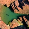
The route continues on the tops past Bawhelps and Mid Hill, and then descends past Badandun Hill. After an abandoned quarry on the left, the route joins the Cateran Trail towards Auchintaple Loch. The woodland it passes was largely clear felled, although a few trees remain. A small track on the right leads down to the loch and into a native woodland.
The route follows along the dam and shortly afterwards a gate is reached. The route then passes a private boat house (locked) and descends on a great gravel track. For the last section, the route rejoins the Cateran Trail back to the start.
This route has been designed by the Cateran Ecomuseum. Find out more about the heritage sites it connects you to.
Location Information:
Address:
Blairgowrie PH11 8PL, UK