DD8, UK
View on MapStrathmore (The Great Glen) forms a wide valley between the southern Grampians and the Sidlaw Hills, extending from Perth in the southwest to Stonehaven in the northeast and including the districts in the northeast known as the Mearns and the Howe of Angus.
Its principal rivers are the Tay, Isla, Dean Water, North Esk and South Esk.
It is approximately 50 miles (80 km) long and 10 miles (16 km) wide. Strathmore is underlain by Old Red Sandstone but this is largely obscured by glacial till, sands and gravels deposited during the ice age.
In some contexts Strathmore is described as extending as far southwest as Dunbartonshire, following the Highland Boundary Fault and effectively designating the south-eastern frontier of that area of the Highlands bounded in the north-west by another, better known, Great Glen. Glamis Castle is the seat of the Earls of Strathmore.
The first recorded history of this region dates to Roman times when the Romans established a series of marching camps generally extending in a south to north direction to support the invasion and exploration northward. Other early examples of history include Pictish stones found in Strathmore such as the Eassie Stone.
Note: location of the pin on Google Maps is a guide only.
DD8, UK
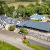
Take a look at things to see and do, places to eat and places to stay around Forfar.